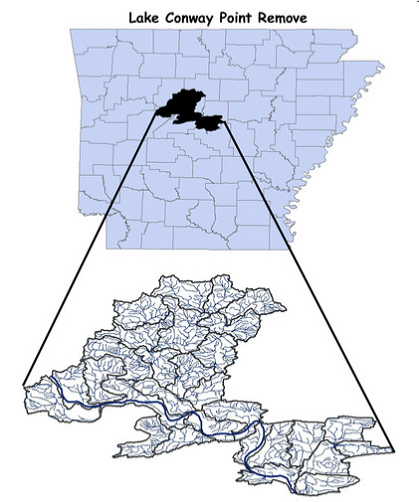
Lake Conway Point Remove (HUC 11110203)
Lake Conway-Point Remove Watershed (HUC 11110203) drains approximately 729,000 acres. The Lake Conway-Point Remove Watershed is made up of five, 10-digit HUC and consists of 29, 12-digit HUC. Majority of land use is that of forests, pastures, and crops. Lake Conway-Point Remove Watershed has four streams listed as 303(d) impaired streams.
We currently have ten water quality monitoring stations to monitoring nonpoint source pollution in the Lake Conway Point Remove HUC. Our goal is to provide parameter loadings and unit area loadings in assorted 12 digit HUC through collecting, analyzing and reporting water quality and discharge data in the Lake Conway Point Removed Watershed.
Our current monitoring stations in the LCPR are at the following locations:
Cypress Creek @ Highway 113
Point Remove Creek @ Highway 64
Lower Clear Creek @ Griffin Flat Road
West Fork Point Remove Creek @ Ed Gordon WMA
West Fork Point Remove Creek @ Griffin Flat Road
West Fork Point Remove Creek @ Pear Tree Road
West Fork Point Remove Creek @ Bridge Hill Road
East Fork Point Remove Creek @ Highway 124
East Fork Point Remove Creek @ Highway 95
Overcup Creek @ Highway 95


