L'Anguille River (HUC 08020205)
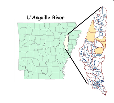
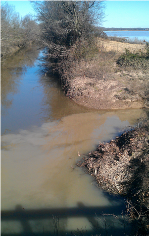
The L'Anguille River is located in eastern Arkansas in the Delta Ecoregion. Land use land cover is mainly row crops consisting of rice, beans, and cotton. The majority of the rivers have been channelized to some extent to accommodate the intensive agriculture practices. The entire length of the L'Anguille River (5 reaches) was included on the Arkansas 1998 303(d) list for not supporting aquatic life due to siltation/turbidity (FTN, 2001).
We currently have five water quality monitoring stations where we monitor for nonpoint source pollution in the L'Anguille Watershed. Our goal is to provide parameter loadings and unit area loadings in assorted 12 digit HUC through collecting, analyzing and reporting water quality and discharge data in the L'Anguille Watershed.
Our current monitoring stations in the L'Anguille Watershed are at the outfalls of the following 12 digit HUC:
Upper Brushy
Middle Brushy
Cooper Creek
Indian Creek
Prairie Creek
To date, Equilibrium has completed one project in the L'Anguille River Watershed, which resulted in an estimation of Unit Area Loadings.
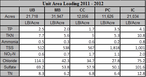
"Unit Area Load is defined as the mass of a particular constituent, transported by a stream, divided by the drainage area of the watershed." (USGS Fact Sheet FS-195-97)
Below are the estimated Unit Area Loads for the subwatersheds during the 2011 - 2012 year.


